
Quick answer
The sapa to ha giang loop distance measures between 320 and 350 kilometers depending on whether you route through Lao Cai or take the direct mountain corridor via Bac Ha. Most travelers cover the journey in seven to nine hours by road, accounting for mountain passes, border-zone checkpoints, and meal stops. The Ha Giang Loop itself begins in Ha Giang City, the provincial capital, where permits are issued and most loop itineraries launch.
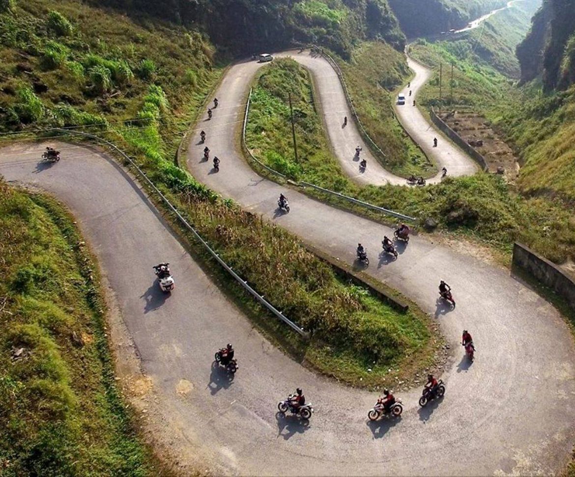
The figure of 320 kilometers understates what the road demands. Between Sapa and Ha Giang City lie three distinct topographic zones: the Red River valley descent from Lao Cai, the agricultural plateau around Bac Ha, and the limestone threshold where the loop's signature karst formations begin. Each zone imposes its own pace, and the cumulative effect reshapes what distance means in this terrain. Two primary routes connect the destinations. The more traveled corridor drops northwest from Sapa to Lao Cai, follows Highway 4D along the Chinese border, then angles south through Bac Ha before reaching Ha Giang City after approximately 340 kilometers. The alternative mountain route cuts directly east through Bac Ha, shaving twenty kilometers but adding technical switchbacks that slow progress. Most shuttle services and private drivers default to the first option for road reliability, while self-riding motorcyclists often choose the latter for reduced traffic and tighter corners. The sapa to ha giang loop distance is less a fixed measurement than a function of your vehicle, weather, and checkpoint delays. Dry-season travel on a reliable motorbike can compress the journey into six hours of hard riding. Wet-season conditions, especially July through September, can double that figure as fog closes passes and mud slows climbs. Border-zone document checks at Lao Cai and occasional police stops along Highway 4D add fifteen to thirty minutes in aggregate, more during holiday periods when domestic traffic peaks. Ha Giang City serves as the compulsory staging base. All loop permits are issued here, and the majority of motorbike rental contracts begin at agencies along Tran Hung Dao Street. Arriving before 16:00 allows same-day permit processing and an early-morning loop departure. The city itself holds little, but its position at the loop's southern terminus makes it the unavoidable waypoint. What matters is not the charm of Ha Giang City but its function: the last fuel, the last reliable repair shop, and the last ATM before the karst. Road surface quality varies sharply by segment. The Lao Cai valley section runs smoothly on recently resurfaced asphalt. The Bac Ha plateau introduces patched pavement and occasional gravel detours where seasonal landslides have forced temporary rerouting. The final approach into Ha Giang City returns to smooth two-lane highway. Potholes cluster in the mid-section, and livestock crossings occur without warning throughout.
“The sapa to ha giang loop distance is less a fixed measurement than a function of your vehicle, weather, and checkpoint delays.”
Navigating the Sapa to Ha Giang Loop Distance and Connectivity
The distance between Sapa and Ha Giang City is approximately 250 kilometers via QL279. Travelers typically approach the Ha Giang Loop by connecting from Sapa through regional bus networks or private transport to the provincial capital.
Sapa Bus Station to Ha Giang Bus Station via QL279
Private transfer via QL279
Rental route via QL279
Planning Your Journey: From Sapa to Ha Giang Loop Distance
This sequence suits riders planning a 4–5 day loop who want to combine both regions without backtracking. Start in Sapa, travel to Ha Giang, complete the loop clockwise, then return south.
Sapa to Ha Giang City
Depart Sapa in the morning and transfer directly to Ha Giang City (approximately 5–6 hours). Arrive by mid-afternoon to collect permits and prepare your motorbike for the following day.
Ha Giang to Quan Ba
Leave Ha Giang City early and ride north through Quan Ba's twin peaks, covering roughly 45 km. The terrain is gentle; use this day to settle into the bike and road conditions.
Quan Ba to Yen Minh to Dong Van
Push northeast through Yen Minh, crossing the Tham Ma Pass before descending into Dong Van (total ~90 km). Arrive before dusk to explore the old quarter and secure accommodation.
Dong Van to Meo Vac via Ma Pi Leng
Tackle the Ma Pi Leng Pass in the morning when visibility is clearest, then descend to Meo Vac (25 km). This is the most dramatic section; allow extra time for photo stops and careful riding.
Meo Vac to Du Gia to Ha Giang City
Complete the southern arc through Du Gia, returning to Ha Giang City by late afternoon (approximately 140 km). Drop off your bike and arrange onward transport the same evening.
Ha Giang City to Hanoi or Sapa
If returning to Sapa, budget another 5–6 hours; most riders head directly to Hanoi instead (6–7 hours). Book sleeper buses the night before to secure a seat.
Best Time to Traverse the Sapa to Ha Giang Loop Distance
The period between September and November offers the most stable climate for navigating the Sapa to Ha Giang route. Prioritizing arrival within the 08:00–16:00 window ensures adequate visibility for high-altitude mountain passes.
September to November
Moderate crowdsClear skies, 15°C to 25°C
This window provides dry roads and comfortable temperatures for long-distance travel.
March to May
Low to moderate crowdsMild spring weather, 18°C to 26°C
Vegetation is lush and temperatures remain pleasant for outdoor transit.
Weekday mornings
Low traffic density—
Arriving during these hours minimizes congestion on narrow mountain roads and optimizes visibility.
Verdict: Plan travel for September to November, strictly adhering to the 08:00–16:00 arrival window to maximize road safety and visibility.
Budget Considerations for Sapa to Ha Giang Loop Distance
Access to the Ha Giang Loop road network is entirely public and does not require an entrance fee. Costs for your journey will instead depend on your chosen method of transit and accommodation requirements.
Travelers pay 0 VND for road access, with total trip costs varying primarily based on vehicle rental and lodging choices.
Daily Access Hours for Sapa to Ha Giang Loop Distance
The roads comprising the route from Sapa to the Ha Giang Loop are part of the public infrastructure and remain accessible at all hours throughout the week.
| Monday | 00:00–23:59 | |
|---|---|---|
| Tuesday | 00:00–23:59 | |
| Wednesday | 00:00–23:59 | |
| Thursday | 00:00–23:59 | |
| Friday | 00:00–23:59 | |
| Saturday | 00:00–23:59 | |
| Sunday | 00:00–23:59 |
Essential Preparation for Sapa to Ha Giang Loop Distance
Prepare documentation and safety gear before departing for the mountain loop.
-
Carry your passport or ID card — Required for police checkpoints along the northern border region.
-
Obtain motorbike license or permit — Traffic police conduct spot checks on the Ha Giang roads.
-
Pack waterproof riding jacket and gloves — Weather shifts rapidly in mountain passes, especially during monsoon months.
-
Bring a full-face helmet — Mandatory for safety on steep, winding descents with loose gravel.
-
Download offline maps for the route — Mobile signal drops completely in remote valleys between Dong Van and Meo Vac.
-
Stock a basic first-aid kit — Medical facilities are sparse; nearest hospital is hours away from most loop sections.
-
Secure travel insurance covering motorbike accidents — Standard policies exclude two-wheeled vehicles on unpaved mountain roads.
Check availability
Frequently asked questions about sapa to ha giang loop distance
Everything you need to know about sapa to ha giang loop distance